About Petite Martinique

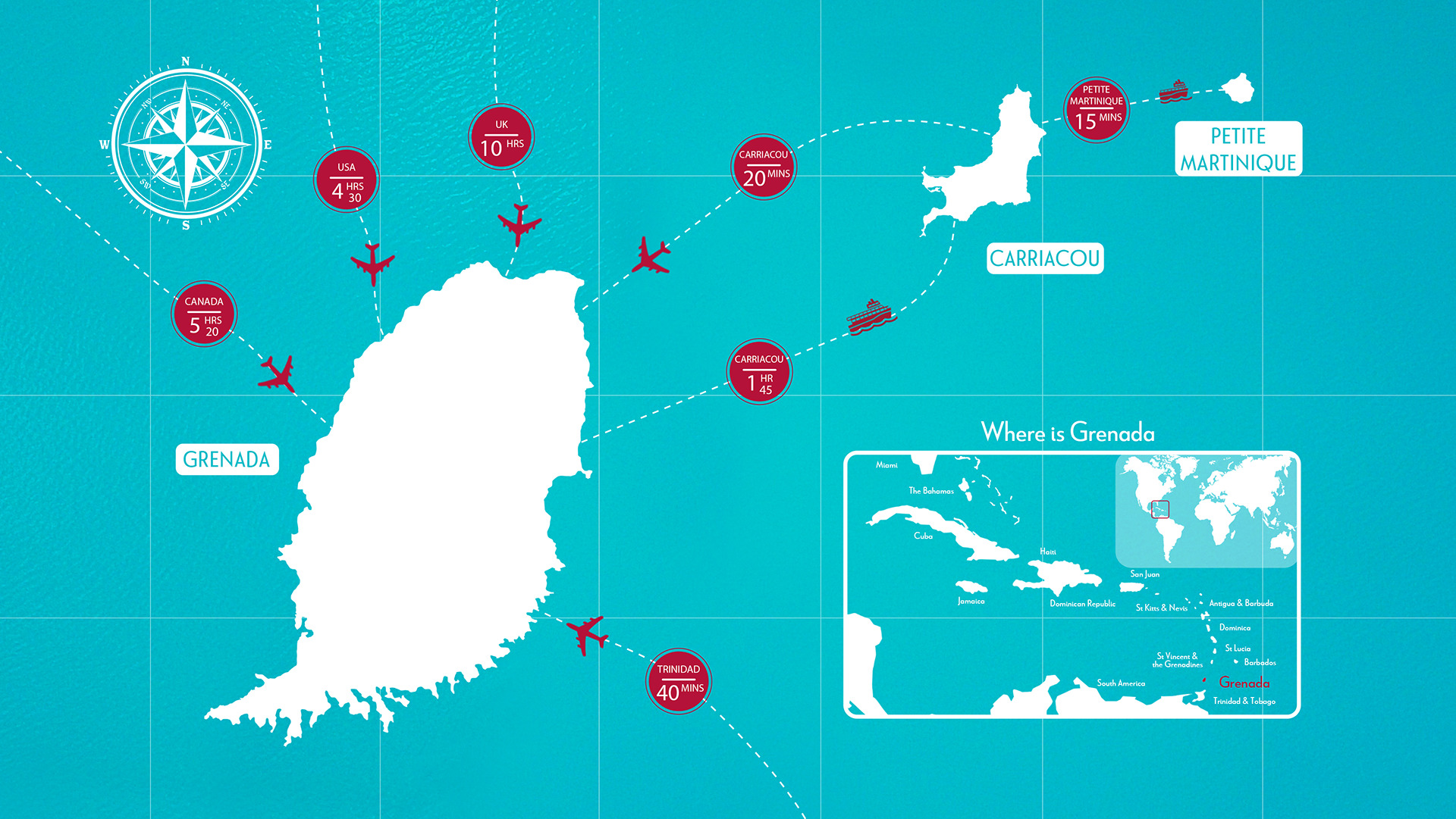
Where is Petite Martinique?

We are known for

Situated to the east of the northern half of Carriacou, this 586-acre island completes the tri-island destination. Approximately 900 residents call this island home, with the majority sustaining their livelihoods through boat building and fishing. Petite Martinique, pronounced as Pitty-Mar-Ti-Neek, is perfect for relaxing, exploring and immersing yourself in the culture of the residents.

The island’s highest point, the Piton, standing at 750 feet, rewards adventure seekers with a thrilling hike and sweeping breathtaking views of the island and nearby Grenadine islands at the summit. This peak was also the location of the traditional maroon feast known as the ‘Sugaring of the Piton.’

The event usually takes place on the morning of Saint Patrick’s Day, March 17th accompanied by a maroon to welcome rain and a good planting season. The tradition involves the pouring of rum and water on the spot on which the participants are gathered. This is referred to as ‘Libation’.

Additionally, the Petite Martinique Whitsuntide Regatta stands out as a signature festival, offering a unique blend of local boat racing, on-shore activities, and the warm hospitality of the island’s residents.

Petite Martinique is not only rich in culture but also blessed with exquisite beaches. Sanchez Beach is a haven for sailing, surfing, diving, kayaking, snorkeling, and fishing, while the serene Mang Beach provides an ideal setting for swimming and family picnics.

Start the fun in Petite Martinique with a quick boat ride over from Carriacou


Petite Martinique
This 586-acre island which completes the tri-island destination is situated east, off the northern half of Carriacou. About 900 persons live on the island, most of whom derive their income from boat building and fishing. Petite Martinique (Pitty-Mar-Ti-Neek) has a strong culture and rich history manifested through its traditions and festivals. The highest point on the island, the Piton (750 feet high) was once the site of the island’s maroon (former slaves) feast also known as the ‘Sugaring of the Piton’.
Previous slide
Next slide

Our People

Our Culture

Our History

This 586-acre island which completes the tri-island destination is situated east, off the northern half of Carriacou. About 900 persons live on the island, most of whom derive their income from boat building and fishing. Petite Martinique (Pitty-Mar-Ti-Neek) has a strong culture and rich history manifested through its traditions and festivals. The highest point on the island, the Piton (750 feet high) was once the site of the island’s maroon (former slaves) feast also known as the ‘Sugaring of the Piton’.

Petite Martinique
This 586-acre island which completes the tri-island destination is situated east, off the northern half of Carriacou. About 900 persons live on the island, most of whom derive their income from boat building and fishing. Petite Martinique (Pitty-Mar-Ti-Neek) has a strong culture and rich history manifested through its traditions and festivals. The highest point on the island, the Piton (750 feet high) was once the site of the island’s maroon (former slaves) feast also known as the ‘Sugaring of the Piton’.
Previous slide
Next slide

Our Stories

Grenada Heritage Map

Pure Grenada has been shaped by an interesting and thrilling mixture of French, African and British influences. Today, accents of our rich and colorful history still remain from our Georgian architecture to beautiful historical forts and ancient rum distilleries. By downloading the Grenada Heritage Map, you will have at your fingertips a virtual map that allows you to browse historical and natural/landscapes – points of interest in Grenada, Carriacou and Petite Martinique and get directions to them. These well-preserved points of interest will surely allow you to step back in history to find out what makes our destination unique. The App is available via the Google and Apple Stores. Just Search ‘Grenada Heritage Map’.

QR Scan to Download

Download Heritage Map

National Symbols